
AVOIDING THE REAL WORLD

SCOPE
B.Arch Thesis Prep Research
ADVISOR
Mitesh Dixit
This thesis, entitled Avoiding the Real World, postulates on alternative urban formations that could circumvent further decline in our current dystopian scenario. This takes the form of the redistribution of people and resources in New Jersey, a state of unique sprawl and density who’s development has been driven by its relationship to the urban centers of New York and Philadelphia. It proposes a renewed interest in the linear city model as a means of effectively densifying the land area and allowing the reappropriation of space for agricultural and clean energy supply, functions that have long been subordinated to home ownership and the expansion of the middle class in New Jersey’s suburbia. This is a critical urban investigation into rethinking the flawed conception of cities and urbanity by focusing on the territorial implications of planning systems.It focuses on the fundamentals of the state’s built environment to show a model of how an altered urban fabric and new urban typologies can be both critical of and suggest a remedy for the effects of the world’s dystopian descent.
“Your problems just called
They know where you are going
And they’ll meet you there”
- Jonathan Rice
The haiku from Jonathan Rice’s collection Farewell My Dudes: 69 Dystopian Haikus presents a statement about society’s outlook on contemporary issues that this thesis seeks to reconcile. Governments, corporations, indeed the majority of the population, recognize the issues plaguing our world and are aware that they will only worsen. However, they do not act to remedy these issues. Continuing on this path, our problems will subsequently meet us with disastrous consequence. The title makes explicit this thesis’ goal to avoid the real world not by dismissing the impending future, but by circumventing our inevitable decline through a critical reinterpretation of dystopian forces within the urban fabric.
Click the link below to view my complete Thesis Prep Booklet, available both as a pdf and on SURFACE, or feel free to continue scrolling to an overview of the included work and writing.


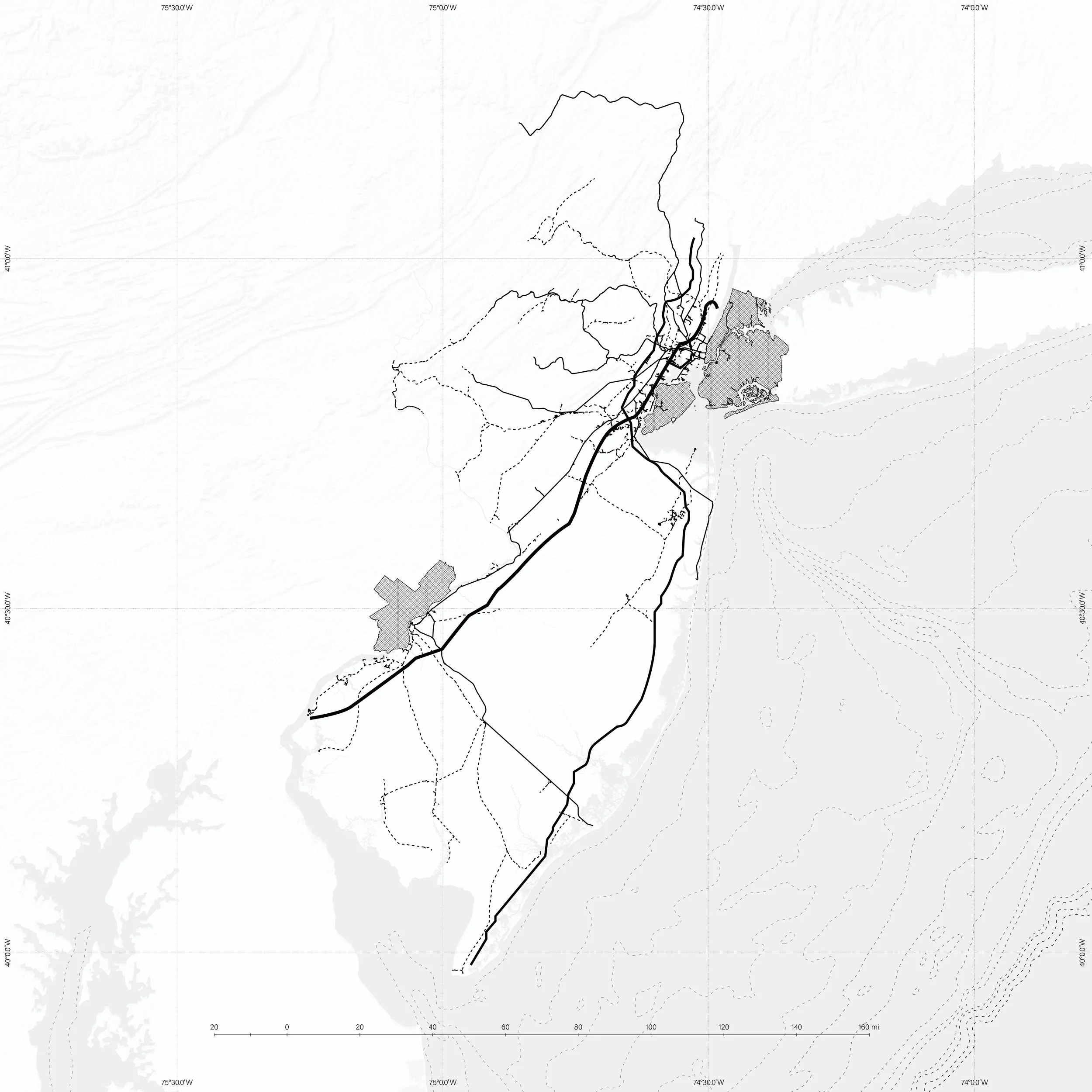


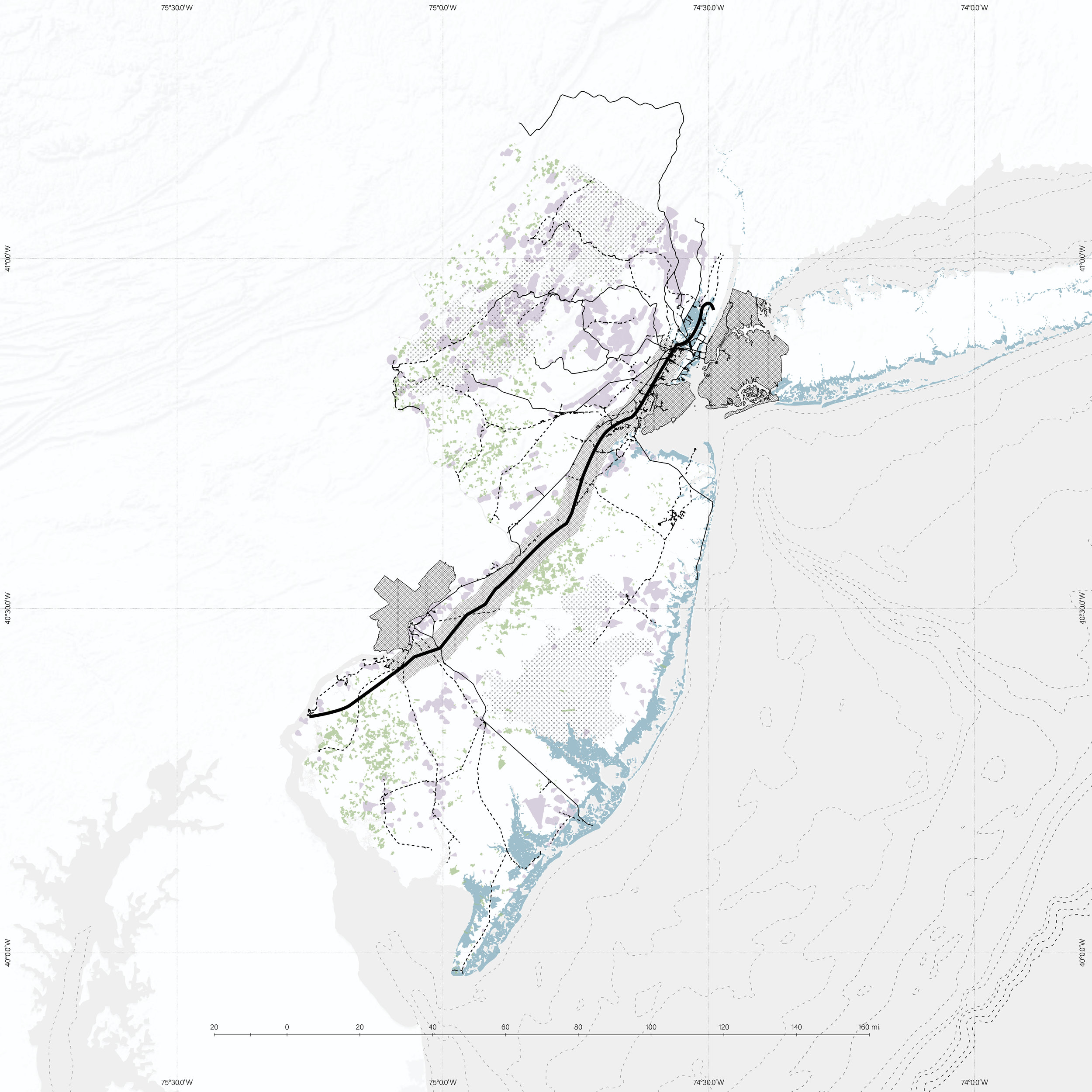
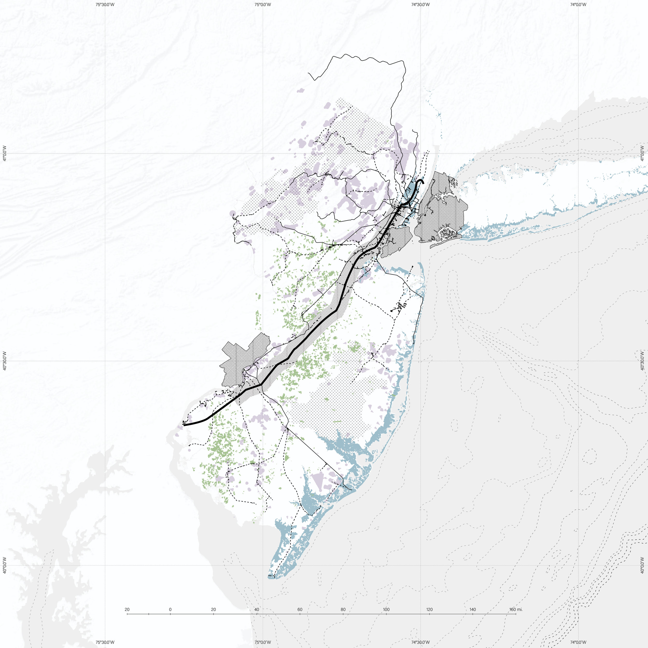
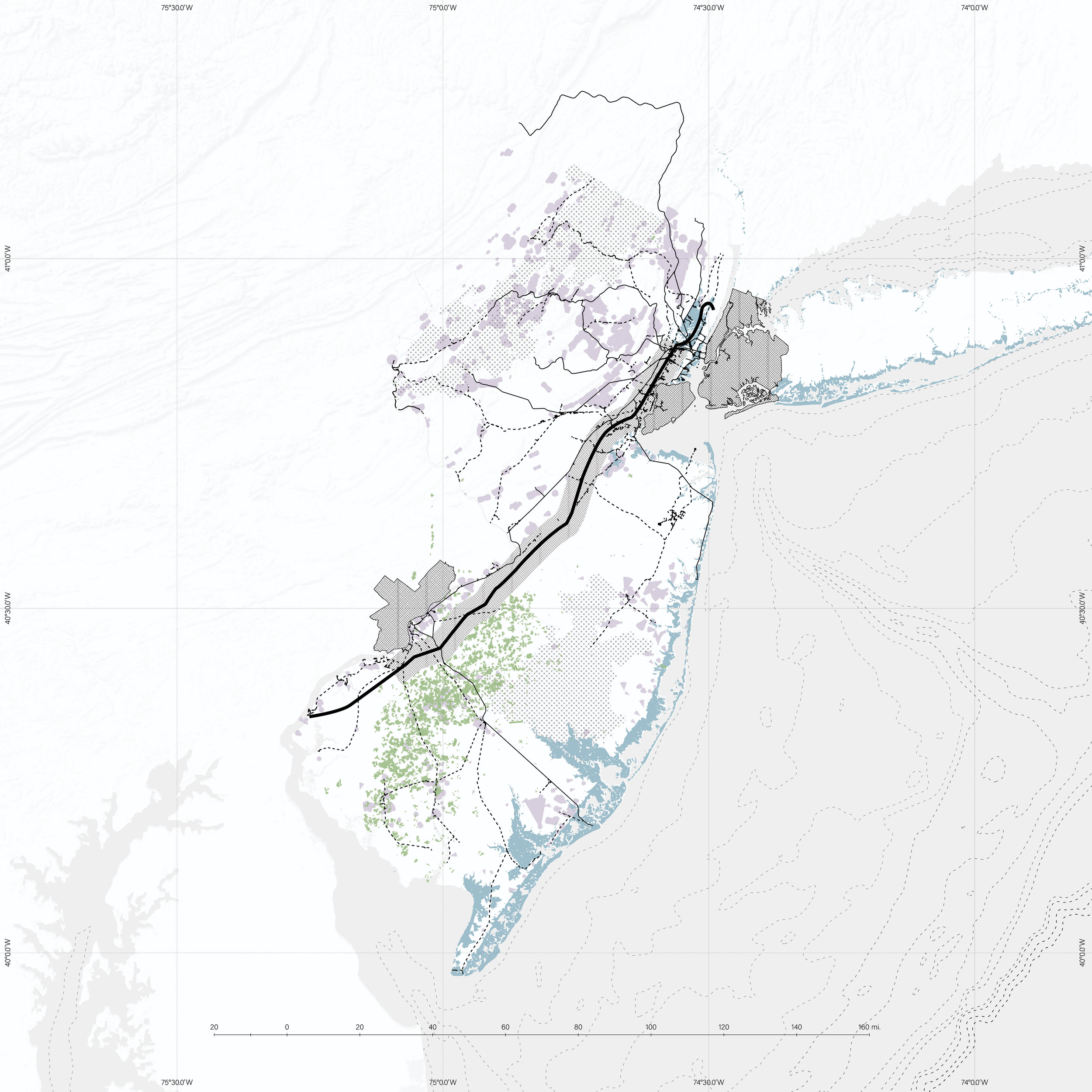
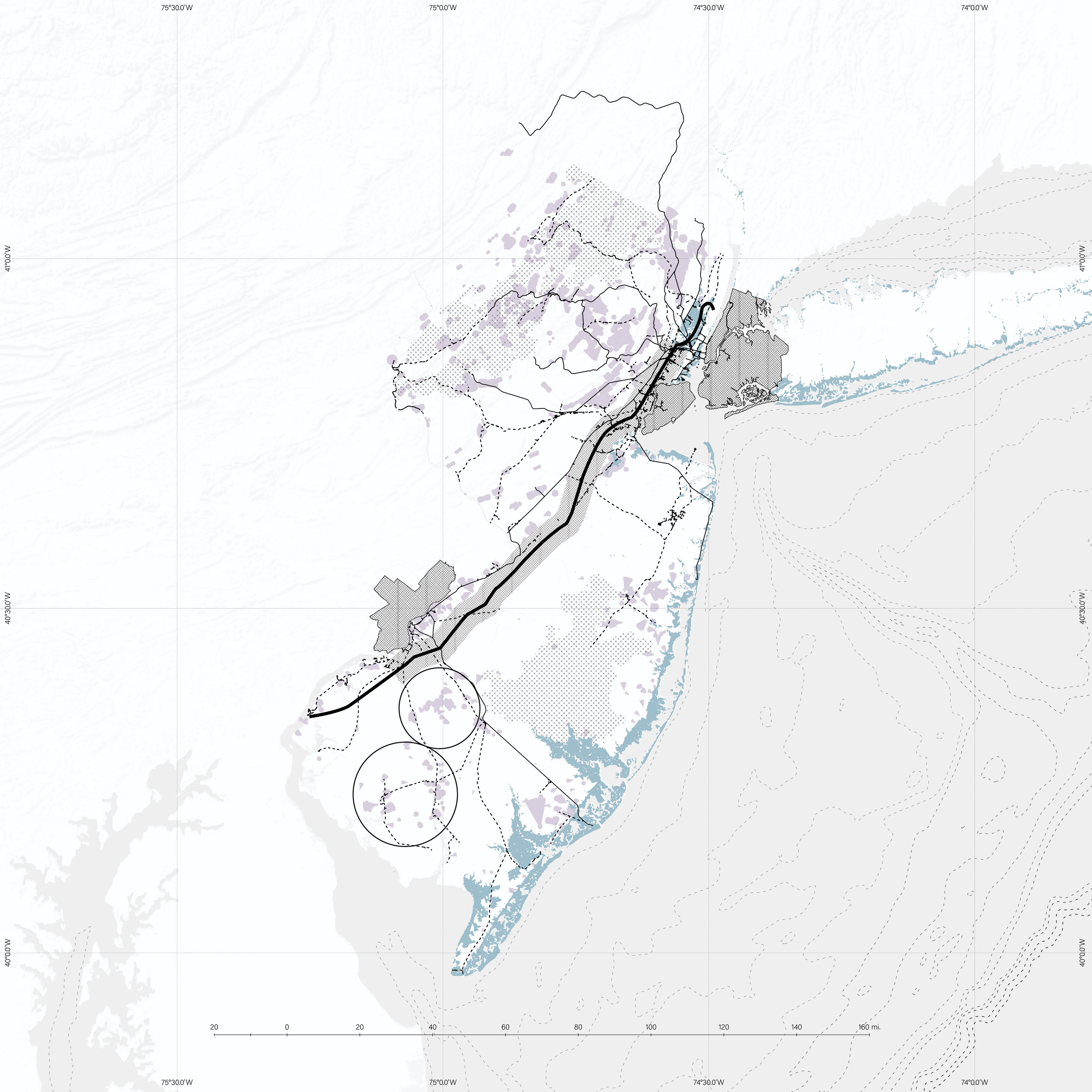
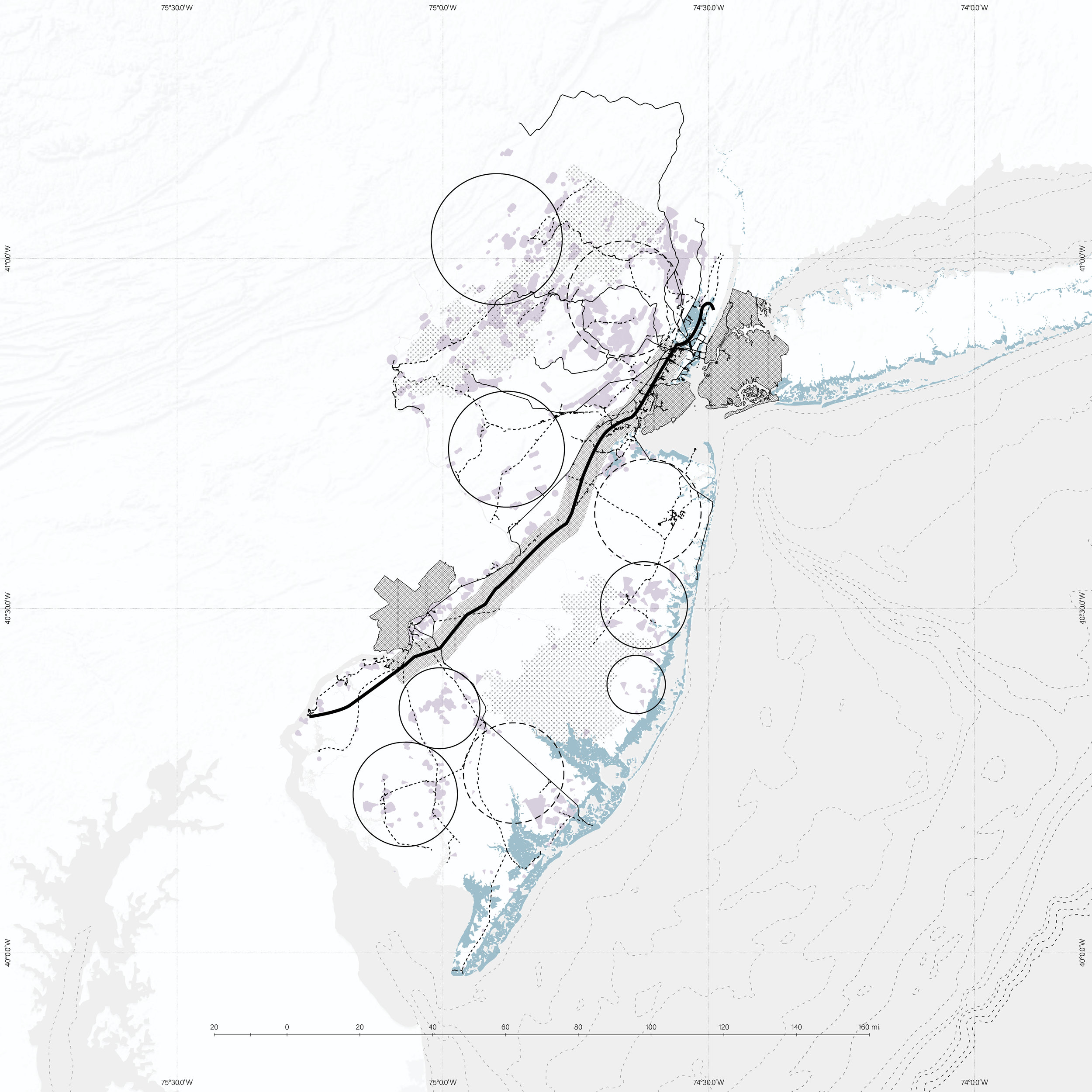
The Testing Grounds
The above maps are dedicated to the representation of the existing conditions in New Jersey and drawing from them a proposal for the redistribution of people, resources and infrastructure in the state. The maps included show first these initial conditions: the NJ Turnpike and Garden State Parkway, key industrial sites, major roadways, the railway system, farmland, preserved land, the spread of blue collar workers, contaminated sites, the most populated cities, urban centers, future coastal flood regions, and population density. These all provide the basis for a planning understanding of New Jersey. New Jersey is seen to be running out of developable land due to the large preserved areas, leading to a decrease in farmland used for increased sprawl. Urban centers tentatively follow the heavily trafficked roads, and the existing train system does not effectively connect the state. Automobile reliance allows only the middle and upper class to expand into the suburbs.New Jersey’s ineffective sprawl is the most evident conclusion from this series of maps, and my proposal at this scale seeks to remedy it.
This last map overlays past maps, making evident a seam between the Pinelands and Highlands preserved areas, where the turnpike corridor connects New York and Philadelphia, home to key industry sites, open areas for development, as well as the state’s most populated cities and a proliferation of the aforementioned suburban sprawl to be fixed. There is a zone between the cities that has the potential for densification and for providing a basis for a clear reorganization of a territory that is so clearly sprawled and deeply flawed by its misconception of urban planning and the city / rural dichotomy.
The Proposal - XL
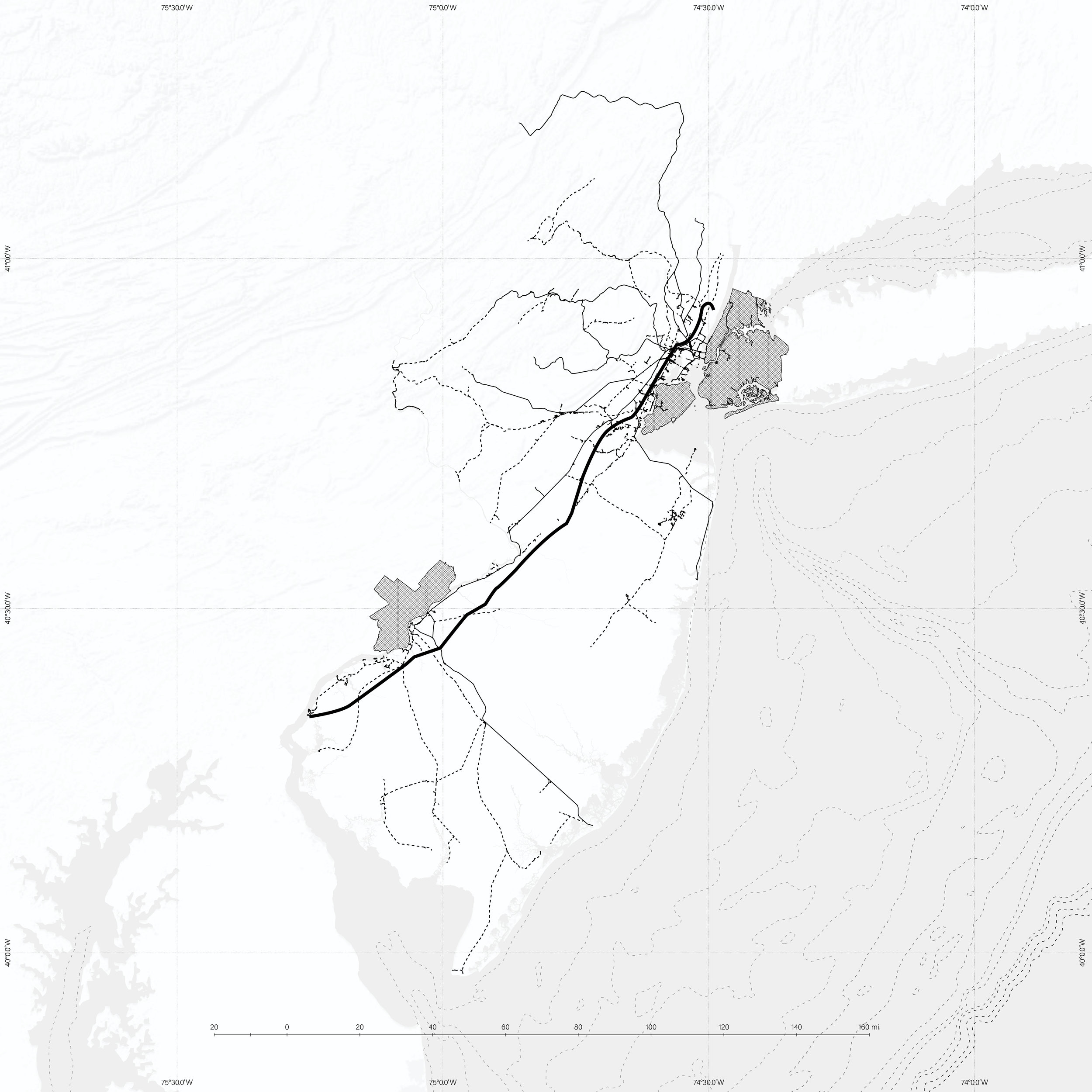
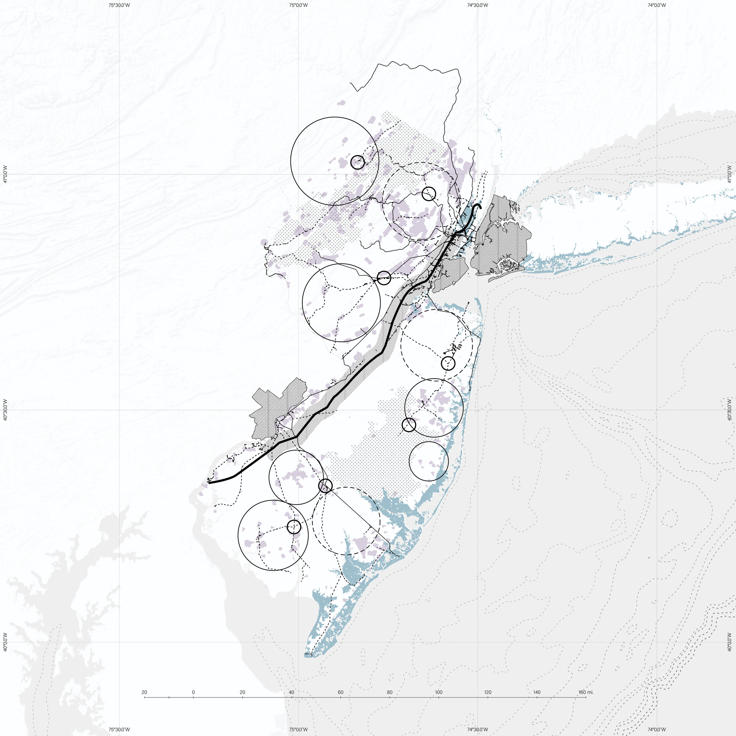
The proposal for New Jersey at the state scale centers on the alteration of the primary corridor, the New Jersey Turnpike. This vital connective piece between New York and Philadelphia is where the urban centers and the population should be redistributed, as seen from the maps of the current conditions. This connective tissue harbors key industry development, minimal preserved land to avoid when developing, as well as the state’s most populated cities and a proliferation of the aforementioned suburban sprawl to be fixed. The state-wide proposal goes through a few key steps: identifying key constraints, relocating urban centers along the primary corridor, increasing the farmland, locating industry sites, and placing secondary transit hubs.
The maps on the right show the first steps, identifying the constraints for this proposal. These maps show the primary turnpike corridor as the location for redevelopment, the existing railways to be selectively adapted, preserved land that cannot be developed, and the projected sea level rise for 2100.
Relocating Centers
The proposal latches on to the existing New Jersey Turnpike, which will be transformed into a set of high-speed rails connecting Philadelphia and New York through the state. Taking the current locations of urban centers from the New Jersey State Development Plan, the first stage is re-densifying the state’s population along this corridor. Shown in the maps below, the proposal takes the existing area of the state development plan’s urban centers and shifts them to flank the new Turnpike rails. Within this zone will be a proliferation of housing and necessary amenities for the people living along the corridor.


Redistributing Resources
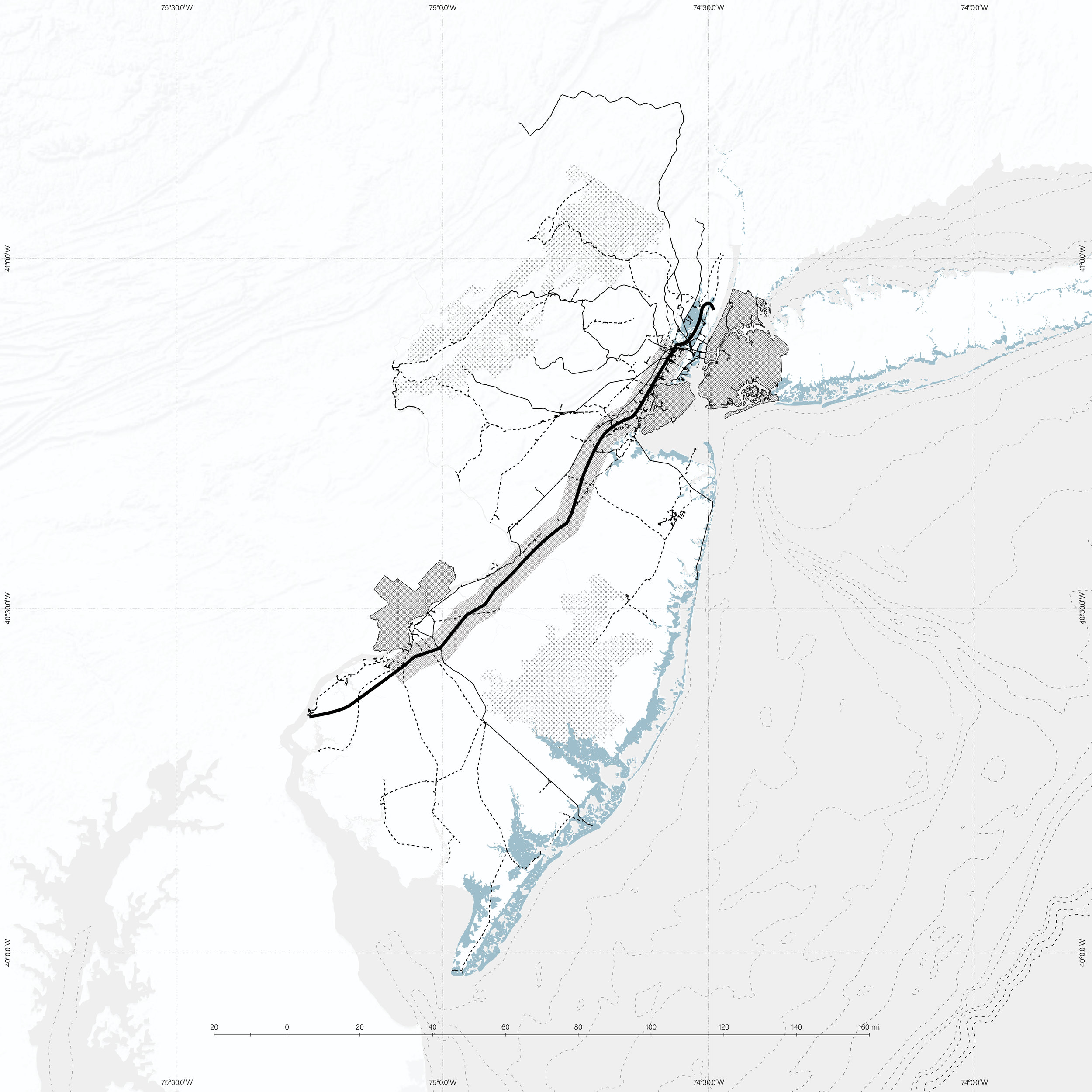
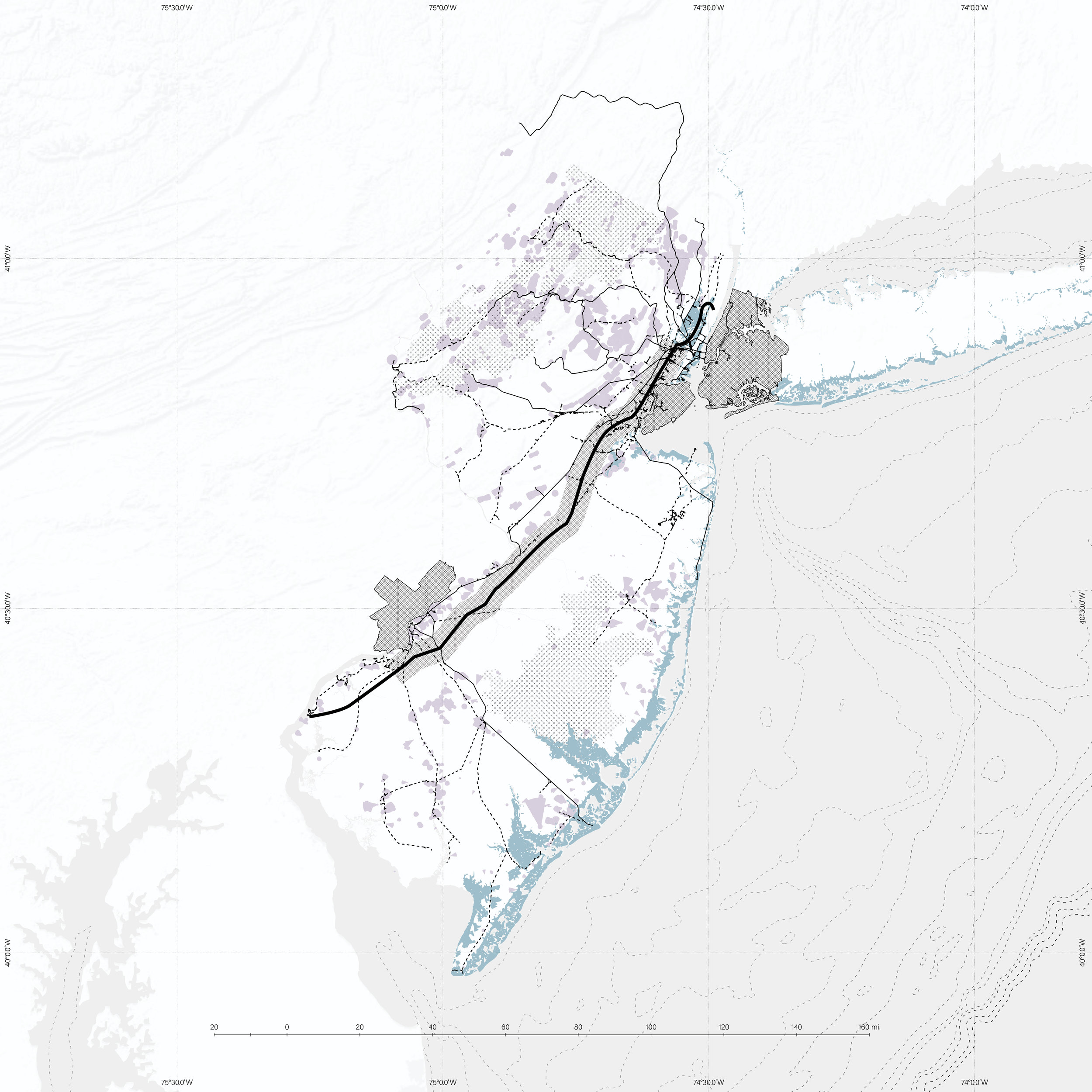
Now that the population has been relocated along the corridor, the newly vacant sprawl areas take the focus of the next step; increasing farmland. The slideshow to the right shows this process. Starting by overlaying the location of public wellheads that would be useful for irrigation, I begin shifting the existing agriculture to prescribed zones. Then I outline expansion zones within which more agriculture could take over, effectively tripling the land area of agriculture in the state. These zones are also determined by the constraints listed previously; they do not infringe on the rising sea level zones, they stay outside of the densified corridor, and they are situated along some existing railways that can be adapted to fit the new territorial scheme.
Then the locations of new industry zones are determined, near some of the more dense regions, where the existing planning could be latched onto and slightly modified for accommodating the pharmaceutical, transport logistics and distribution, and advanced manufacturing sectors that are spread through the state. A few industry zones are already located in these highlighted areas, and the existing infrastructure will be streamlined to fit out the now vacant areas and bring these goods back into the new corridor. Linked to the industry and agriculture zones is the final step, placing secondary transit hubs to bring back the goods and resources produced into the newly densified urban corridor. They can be spread to the residents of the state, to Philadelphia and New York, or exported.
This new scheme shows a more effective overall layout of the territory, redistributing people and resources through some of the existing infrastructure to combat the misuse of land and closure of the suburban sprawl paradigm. This system rejects the use of typical city planning paradigms and in doing so seeks to project a case study for the reinterpretation of other similar landscapes. The specifics of the replanning and new operation of this corridor will be outlined in the next section, as this proposal calls itself what it is, a linear city, and takes notes from the similar theoretical exercises that came before it, as well as Albert Pope’s insights into urban planning.


Precedent analysis
The first set of images below are the precedents that I examined to provide the pieces for my proposal for New Jersey. In order of conception, it is evident from these key images that they share key similarities, but also have different overall schemes. The format of this section as stated earlier takes these projects and breaks them down into categories by how they function. The categories are then taken and broken down into the pieces that form them.
The second set of images are diagrams of these project, breaking down the key aspects such as primary circulation, secondary circulation, transit hubs, and the allocation of residential, industrial and agricultural programs. Basic information is then drawn from them to give an overall view of linear city schemes, unveiling an emphasis on campus style distribution of buildings, typically mid-rise structures, and an emphasis on open space and mixed program in close proximity.
Linear Cities


Linear City Diagrams


The Types
The types of linear cities I derived from the investigation of the aforementioned precedents are the Line, Line + Ladder, and Line + Grid, which correlate with Albert Pope’s categories the band, spine, and linear grid, respectively. Each category takes a different stance on how transportation infrastructure, program allocation, and density should be linked.
Line
The line paradigm is the most simple, a connective transportation corridor with program disbursed directly adjacent, limiting any cross axial movement. This mode features a consolidated movement of goods and people along this efficient through-way, as well as direct access to housing and amenities. However it fails in its complete lack of lateral movement, and in that way it is easy to break down, as seen in both the movie Snowpiercer and J.G Ballard’s novel High-Rise.
Line + Ladders
The line + ladders category begins to touch on these downfalls, with ladders extending from the transportation core out into the landscape. This creates connections away from the main transportation, allowing for a lateral reach of program, with many schemes emphasizing these ladders as potential connections to a natural landscape. Within this outer context, the ladders support a greater spacing of units and interstitial space for alternative uses. However, these ladders com with their issues, many of which are outlined by Pope. They are inherently hierarchical and closed systems that manipulate and limit the flow of people, which in turn is linked to many suburban issues such as congestion, reliance on non-public transit, and an isolation of elements from the core system.
Line + Grid
The final category, which is the basis for my linear city intervention, is the line + grid. An offshoot of the linear grid Magnitogorsk pointed to by Pope, the line + grid locates the linear transport core within a centrifugal grid system. The grid spans out from the center, allowing for multiple cross axis circulation paths, as well as additional circulation parallel to the main transit line. This method creates ambiguity and openness for the occupants and cuts down on prescribed pathways inherent in the line + ladder method, while also maintaining a (though somewhat shorter) reach out into the “countryside.”
The Proposal - L
This proposal takes a fraction of New Jersey along the outlined corridor and re-plans it according to the previous principles and pieces. The section taken for this portion of the thesis spans through the Somerset, Mercer, Monmouth, Middlesex and Ocean Counties of New Jersey, and was chosen because it captures the key elements of New Jersey; the coastline, pinelands, suburban sprawl, the (edge of) failed cities, industry, agriculture zones, as well as the key Turnpike corridor.
The existing condition, seen below, shows two suburban development zones on the periphery of more dense infrastructure located along the coast and the outskirts of Trenton. A few water bodies and small rivers spot the landscape, and some open lots hold pinelands preservation and small agriculture zones.


Adding Lines
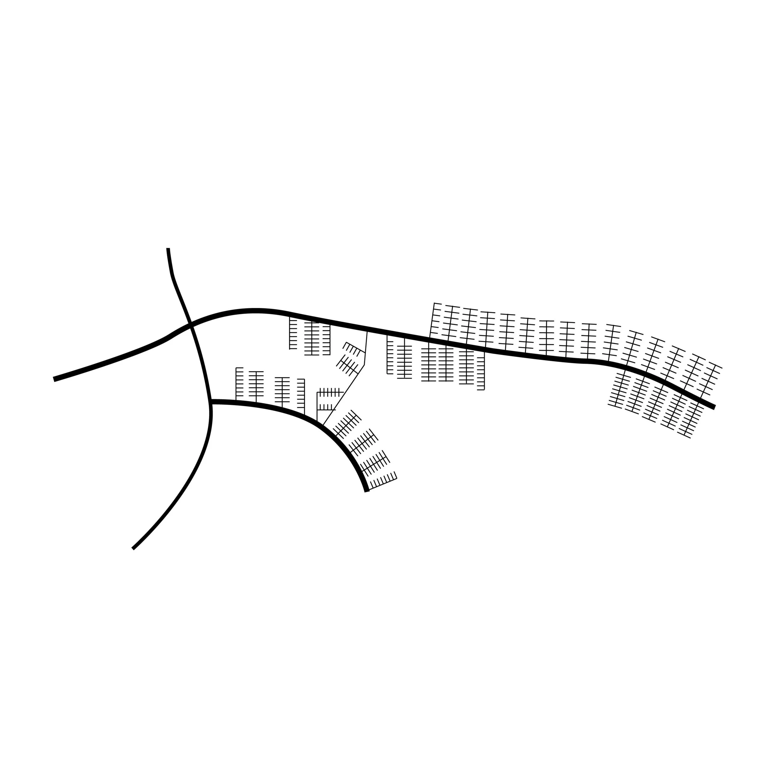
This portion of the proposal begins by applying The Pieces with the application of the Line to the site. The line takes the form of the new high speed railway from New York to Philadelphia along the Turnpike. Once this primary circulation path is established, the next step is an investigation of the existing train lines. Some of these segments are then re-appropriated for use within the scheme, starting to create connections into the broader territory where agricultural and industrial program will be allocated. From there, key intersections are noted among this new system, creating locations for ladders to feed back to. This secondary system is then fully linked with the addition of minor railways to the key intersections. The maps on the next page show these two steps, the identification of the existing infrastructure and then highlighting the new system.


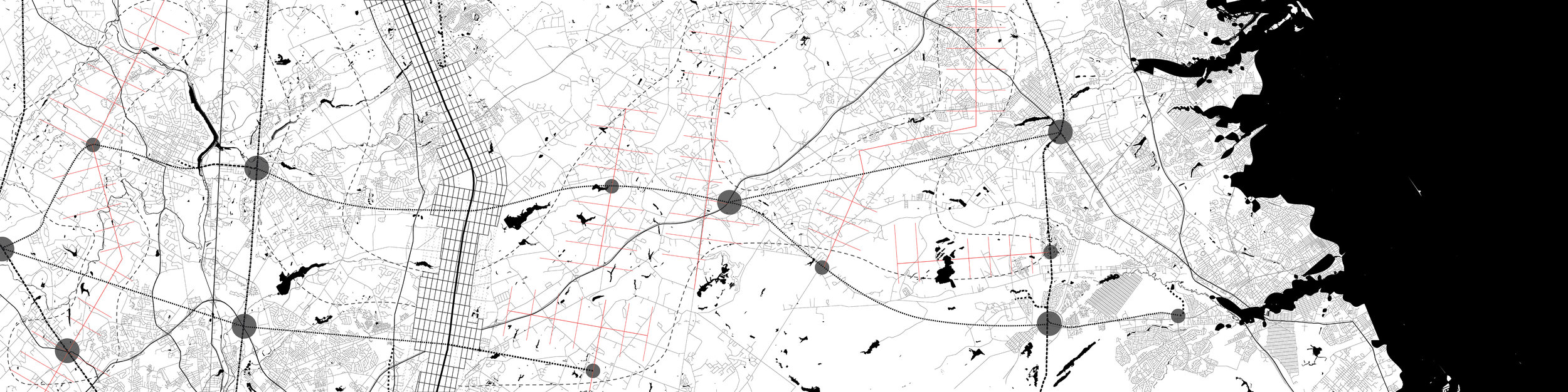
Adding The Grid
After the line infrastructure is solidified, the next step is adding the grid, which is necessary to expand outward from the main line. This circumvents the issues with the line paradigm by eliminating ease of breakdown and allowing for cross axial connections. The grid is added and set to grow as people are brought in to the new scheme. The gridded spatial field extends two and a half miles to either side, undulating within these parameters as it responds to elements in the context. The limit of the grid’s extent is necessary to keep away from current city issues of over-expansion into the field with poor infrastructure to circulate back into the center. The benefit of the grid also extends into the field of Albert Pope’s description, as it is capable of hosting heterogeneous program, density and openness of built form.
The drawings to the left show the overlay of the grid within the existing site, and the expansion of the system slowly outward as people would begin to populate the new scheme.

Adding Ladders
With the grid in place, ladders are then extended into the areas necessary for reclaiming agriculture. These ladders are only used for the movement of goods and solely people who work in agricultural labor, keeping their negative effects as pieces of the urban fabric at bay. These closed systems now effectively bring products back along the secondary transportation routes added in the Line step to the main corridor and the grid, for dispersion to the populous.
A New Picture
Now, a new picture of the region is developed, a new hierarchy of movement, with a free, open gridded system along the main corridor, and a takeover of agricultural and industrial production all feeding back into the densified line. The application of different urban pieces derived from Albert Pope and past linear city models produces an amalgamation of urban form. Each piece has been adjusted and used to combat past failures, whether it was used poorly in city planning, modernist development, post-war grid dissolution, or it was a negative aspect of the linear city examples.
The collages on the right show how this proposal will begin to be architecturalized over the existing context of the New Jersey Turnpike, highlighting the main infrastructural corridor and the large open swaths of grid to house heterogeneous forms of development.
The collages below show what this landscape would look like in New Jersey, comparing the old view of this sliver of the territory to the redistributed scheme.


The Conclusion
This thesis is an urban planning investigation focused on the sprawl of New Jersey between two urban nodes as an area representative of the dystopia that has been produced in the current age. The reorganization of people using urban planning methodologies based on the linear city model attempts to reinterpret the underlying infrastructural issues that have developed problems in the state and in the country as a whole. I believe the proposal takes significant, necessary steps to avoid the real world, our impending worsening dystopia, as it proposes an alternative look into an area of decline and redistributes the elements of the state to counter the negative forces at play.

Thesis Prep Booklet
Click the Image to view!